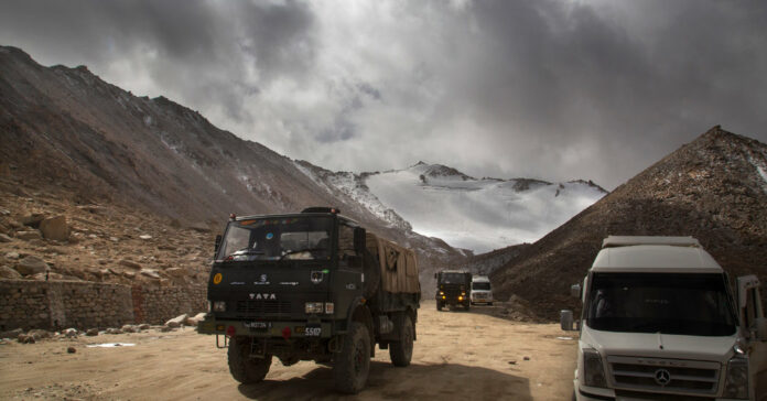
The countries went to war over the boundary in the Himalayas in 1962. Despite an uneasy truce and a “Line of Actual Control,” clashes still erupt.

Twenty Indian soldiers were killed by Chinese troops late Monday in a clash along the disputed India-China border, the first such episode in decades, military experts said. The violence is a continuation of a decades-old dispute between the two nuclear powers over the precise location of their Himalayan border.
What is the ‘Line of Actual Control’ and why does it matter?
Six decades ago, India and China went to war over a border dispute that ended with an uneasy truce in 1962.
While no border has ever officially been negotiated along the forbidding stretch of land high in the Himalayas that divides the two nations, the truce established a 2,100-mile-long Line of Actual Control.
Since then, an uneasy peace has held. But every time there is a flare-up of violence, the world watches anxiously.
China and India are the two most populous nations on earth, both armed with nuclear weapons, led by governments that have built support, in large part, by appeals to nationalist sentiment.
In recent months, tensions have spilled over into brawls between soldiers. And late Monday, the violence reached dangerous heights when the 20 soldiers, including an army officer, were killed by Chinese troops.
It was said to be the first time in decades that the fighting at 14,000 feet had led to casualties.

CHINA
PAKISTAN
Diamer Bhasha dam
CHINA
NEPAL
GILGIT-
BALTISTAN
Controlled by Pakistan
Area of detail
Disputed borders
or ceasefire lines
CHINA
INDIA
Galwan Valley
JAMMU
AND KASHMIR
Controlled by India
Pangong Tso
CHINA
CHINA
PAKISTAN
INDIA
Naku La
NEPAL
BHUTAN
100 miles
BANGLADESH

Diamer Bhasha dam
CHINA
CHINA
PAKISTAN
GILGIT-
BALTISTAN
Controlled by Pakistan
NEPAL
Disputed borders
or ceasefire lines
CHINA
Area of detail
Galwan Valley
JAMMU
AND KASHMIR
Controlled by India
INDIA
Pangong Tso
CHINA
CHINA
PAKISTAN
INDIA
Naku La
NEPAL
BHUTAN
100 miles
BANGLADESH

CHINA
CHINA
GILGIT-
BALTISTAN
Controlled by Pakistan
PAKISTAN
Disputed borders
or ceasefire lines
NEPAL
CHINA
Area of detail
Galwan Valley
JAMMU
AND KASHMIR
Controlled by India
INDIA
Pangong Tso
CHINA
CHINA
PAKISTAN
INDIA
Naku La
NEPAL
100 miles

CHINA
CHINA
GILGIT-
BALTISTAN
Controlled by Pakistan
1
Disputed borders
or ceasefire lines
Area of detail
CHINA
2
INDIA
JAMMU
AND KASHMIR
Controlled by India
3
CHINA
CHINA
PAKISTAN
4
INDIA
5
NEPAL
100 miles
1
2
3
4
5
Diamer Bhasha dam
Galwan Valley
Pangong Tso
Lipulekh Pass
Naku La

CHINA
Disputed borders
or ceasefire lines
1
Ctrl. by Pakistan
CHINA
2
Ctrl. by India
3
CHINA
CHINA
PAKISTAN
4
INDIA
NEPAL
5
100 miles
1
2
3
4
5
Diamer Bhasha dam
Galwan Valley
Pangong Tso
Lipulekh Pass
Naku La
CHINA
PAKISTAN
NEPAL
Area of detail
INDIA
What are they fighting over?
While the Line of Actual Control was devised to create a demarcation line and to ease tensions between the nations after the 1962 war, many areas remain in dispute.
Both China and India have pressed their claims by building up infrastructure like roads, telephone lines and airstrips, and by sending troops on regular patrols.
The demarcation line runs through a territory known as Ladakh. It is part of Kashmir but located in the region’s lesser-known Buddhist region.
Ladakh borders Tibet and is even sometimes referred to as Little Tibet. Sitting at the crossroads of several important trade routes, the territory has a rich history of commerce. But that came to an end when China closed the borders with Tibet and Central Asia in the 1960s.
Now, the sparsely populated but stunningly beautiful land is mostly known as a tourist destination.
What led to the current standoff?
In May, an enormous brawl broke out between Chinese and Indian soldiers stationed at camps high in the Himalayas.
Beijing’s reaction was swift and forceful.
Chinese troops confronted Indian soldiers at several other remote border points in the mountains, some more than 1,000 miles apart. Since then, both armies have rushed in thousands of reinforcements. Indian analysts say that China has beefed up its forces with dump trucks, excavators, troop carriers, artillery and armored vehicles and that China is now occupying Indian territory.
And as the world has been distracted by the coronavirus pandemic, Beijing has taken a series of aggressive actions in recent weeks to flex its economic, diplomatic and military muscle.
For India, the Chinese incursions and maneuvers at multiple points along the demarcation line have raised suspicions of a concerted campaign to exert pressure on the government of Prime Minister Narendra Modi.
The spark for the recent tensions seems to have been a road to a remote air force base that the Indian Army is building through mountain passes in the Galwan Valley, which military analysts say is fully within Indian territory. Experts say that the Chinese are determined to frustrate India’s efforts to upgrade its military positions.
Preliminary reports on Tuesday indicated that the Indian soldiers had not been shot, but had been killed in a fight involving rocks and wooden clubs.
It was not immediately clear how India would respond.


