SCU LIGHTNING COMPLEX FIRE
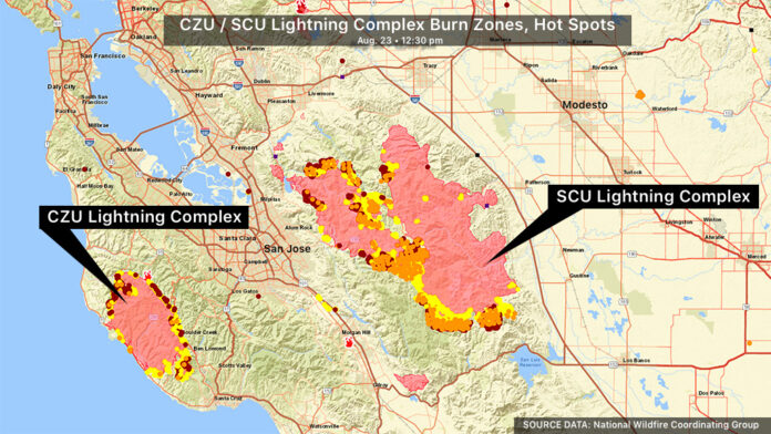
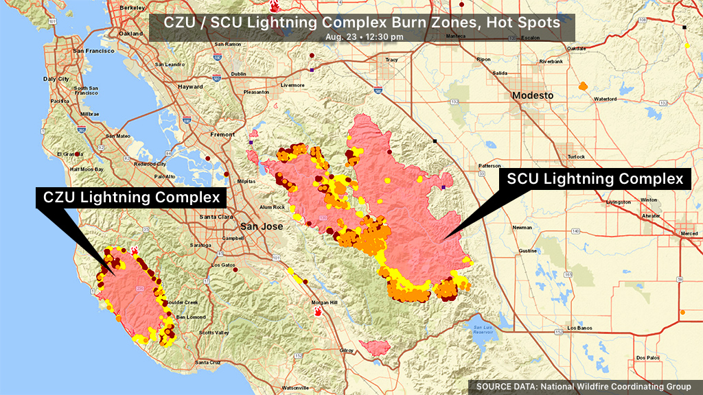
The SCU Lightning Complex started on Aug. 16 with multiple fires within the complex. These fires have since merged into two major fires and are broken into three zones: Canyon, Calaveras and Deer.
COUNTIES: Multiple locations throughout Santa Clara County, Alameda County, Contra Costa County, San Joaquin County and Stanislaus County
ACRES BURNED: 339,968
CONTAINMENT: 10 percent
LATEST COVERAGE: Firefighters Brace for Long Battle; New Evacuations Ordered
EVACUATION ORDERS:
Alameda County
All of Mines Road, south of Mile Marker 10 to the county line
South of Welch Creek Rd. to the fire perimeter
Alameda/Santa Clara County Line East of Calaveras Rd. at Welch Creek Rd. to the fire perimeter
San Joaquin County
South of West Corral Hollow Road to Stanislaus County line
West of I-580 to Alameda County line
East of Alameda County line to I-580 and the Stanislaus County line
Santa Clara County
North of Magnolia Ct. and Magnolia Way,
East of Lower Thomas Grade along the East Dunne Corridor
East of Hwy 101 to Meltcalf Rd.
East of Coyote Creek,
East of Cochrane Rd.,
East of Hill Rd.,
South of Main Ave. North of Dunne Ave., West of Shingle Valley Rd. and Anderson Lake to include the Jackson Oaks and Holiday Lake Estates
South of Metcalf Rd.
East of San Jose City limits
South of Mt. Hamilton Rd.
North of Metcalf Rd. & San Felipe Rd., East to the County Line
East of San Antonio Valley Rd. to Del Puerto Canyon Rd. to the County Line
South of Stanislaus County Between Santa Clara County Line and I-5
West of I-5 North of Stanislaus/Merced County Line
North of Stanislaus/Merced County Line
East of Santa Clara County Line, East if Ed Levine County Park, Felter Rd., Sierra Rd., Toyon Ave., and Mt. Hamilton Rd. Three Springs Rd.
Toyon Ave., and Mt. Hamilton Rd. to Three Springs Rd.
North of Hwy 130 to Santa Clara County Line
West of San Antonio Valley Rd.
West of Mines Rd. to Santa Clara County Line
East of 3 Springs Rd. and Mt. Hamilton Rd.
South of Santa Clara County Line
North of Mt. Hamilton Rd. to Three Springs Rd.
South of Santa Clara County Line
West of the Fire Perimeter
East of Ferguson Rd. East and North of Hwy 152
West of Merced County Line
North of Hwy 152
South of Metcalf Rd at Shingle Valley Rd.
East to the Stanislaus County line
East of Shingle Valley Rd. and everything East of Anderson Lake, East of Coyote Creek
East of Coyote Reservoir, East of Roop Rd., East of Leavesley Rd., East of Crews Rd
East of Ferguson Road.
East and North of Hwy 152
West of Merced County Line, North of Hwy 152
South of Metcalf Road at Shingle Valley Road, East to the Stanislaus County Line
Alameda County / Stanislaus County:
Frank Raines Park to Mines Road
Del Puerto Canyon Road 1 mile to Mines Road
CZU LIGHTNING COMPLEX FIRE
The CZU August Lightning Complex fire continues to burn in Southern San Mateo County and Northern Santa Cruz County.
COUNTIES: San Mateo County; Santa Cruz County
ACRES BURNED: 67,000
LATEST COVERAGE: 77,000 Driven From Threatened Homes; Big Basin State Park Devastated by Flames
EVACUATION ORDERS
San Mateo County
Communities of Loma Mar and Dearborn Park Area (Zone SMC E018)
Pescadero Creek County Park Area (Zone SMC E024)
Butano Community Area (Zone SMC E098)
Butano State Park Area including Barranca Knolls Community (Zone SMC E019)
Butano Creek Drainage (Zone SMC E055)
South Skyline Blvd. Area near Highway 9 (SMC E049)
Russian Ridge Open Space Reserve Area (Zone SMC E027)
Middleton Tract Area (Zone SMC E044)
Portola Redwoods State Park and the Portola Heights Community Area (Zone SMC E048)
Pescadero Beach Area (Zone SMC E075)
Bean Hollow Area (Zone SMC E042)
Pescadero Area (Zone SMC E043)
San Gregorio Area (Zone SMC E022)
La Honda Area (Zone SMC E028)
Red Barn Area (Zone SMC E010)
Russian Bridge Open Space Area (Zone SMC E027)
Skylonda Area (Zone SMC E012)
Langley Hill Area ( Zone SMC E010)
Bean Hollow Area (Zone SMC E042) (8/20/2020 6:00 pm)
Santa Cruz County
Waterman Gap Loop, Upper Hwy 236, Boulder Creek Golf Course, Heartwood Hill, Lodge Road, Community of Little Basin, Lower China Grade, Upper China Grade, Community of Kings Hwy, Lower Jamison Creek, Gallion Heights, Fallen Leaf Neighborhood, Foxglove Lane
Saratoga Toll Road, San Lorenzo Park, Riverside Grove-Community of Teilh Drive, Wildwood Road
Everyone on Empire Grade Road, from Felton Empire north, all of Pine Flat Road, all of Ice Cream Grade, Bonny Doon Road, in between Pine Flat Road, Martin Road, and all associated side streets are under an evacuation order.
Bonny Doon south of Ice Cream Grade, to include Pine Flat Road South is now under an evacuation order
Areas of Alba Road, Hubbard Gulch and Fanning Grade.
All areas of Ben Lomond
The area of Lompico
All areas adjacent to the Bonny Doon and San Lorenzo Valley should be prepared to evacuate if necessary
Areas West of Highway 9 to Empire Grade
South from Bear Creek Road to Felton, this includes Ben Lomond
Paradise Park
University of California Santa Cruz, campus only
The areas of Zayante Canyon
Scotts Valley West of State Route 17
Davenport south
All areas of Felton
CALIFORNIA WILDFIRES COVERAGE
- CZU Lightning Complex: Cal Fire Says Looter Stole Fire Commander’s Wallet, Drained Bank Account
- LNU Lightning Complex: Shifting Wind Pushes Walbridge Fire Toward North Bay Communities
- LNU Lightning Complex: 533 Square Miles Burned As 2nd Largest Ever California Wildfire Enters New Week
- CZU Lighting Complex: More Than 77,000 Driven From Threatened Homes; Video: Big Basin State Park Devastated By Flames
- Red Flag Warning Issued for Fire-Ravaged Northern California
- LNU Lightning Complex: Areas Of Healdsburg, Lake County Among Latest Evacuations Ordered
Copyright 2020 CBS Broadcasting Inc. All Rights Reserved. This material may not be published, broadcast, rewritten or redistributed


